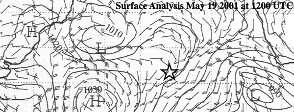
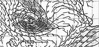
A cold high south of the low is slowly moving eastwards along its latitude
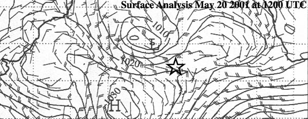
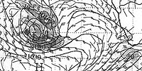
The day when the low has developed into a hurricane. The position seems to be a little westerly
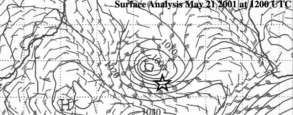
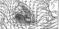
The eye of the hurricane passes right over the island
Here follows the weather-forecasts available at the Swedish Met Office in Norrkoping
|
May 18 12UTC +72 hours
|
May 18 12UTC +96 hours
|
|
 |
 |
|
|
May 19 12UTC +48 hours
|
May 19 12UTC +60 hours
|
May 19 12UTC +72 hours
|
 |
 |
 |
|
May 20 12UTC +24 hours
|
May 20 12UTC +36 hours
|
|
 |
 |
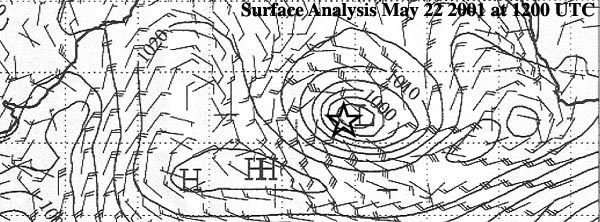
Even the forecasts made on May 16th and 17th shows a similar picture for May 21-22.
Weathercharts - courtesy of SMHI/ECMWF
John Ekwall, SMHI (Swedish Met Office) June 22, 2001